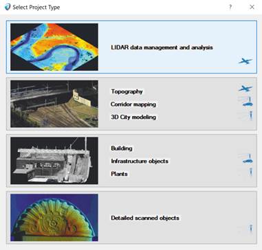
Before importing scan data first project creation step requiring select project type based on your scan data set:
•LiDAR data management and analysis (The most common choice for large airborne LiDAR projects);
•Topography, corridor mapping, 3D city modeling (The most common choice for infrastructure projects);
•Buildings, Infrastructure objects, plants (The most common choice for terrestrial scanners);
•Detailed scanned objects (The most common choice for small detailed objects such as: monuments, parts of buildings or areas with a footprint up to 100m2);
Note regarding Undet project creation:
Selecting the right project type speeds up the indexing process, without losing full point cloud points and effects only preview view.