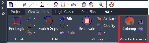
• - Changes Point Cloud Object’s
in Active View Section coloring settings of by Intensity, by Height
(Z-value) or by Distance from Reference Plane coloring options
through launched dialog box
- Changes Point Cloud Object’s
in Active View Section coloring settings of by Intensity, by Height
(Z-value) or by Distance from Reference Plane coloring options
through launched dialog box
• Change Plane -
Defines Plane by clicking on one of the View Section face. This is Reference
Plane for coloring intervals assignment using by Distance from Reference
Plane coloring option.
Change Plane -
Defines Plane by clicking on one of the View Section face. This is Reference
Plane for coloring intervals assignment using by Distance from Reference
Plane coloring option.
• Generate Image
- Converts Active View Section to raster image co-planar to Screen Plane
view. Launches Image Preview Dialog Box, where you can set grid cell size
in square meters to define image precision and detail level. It is strongly
recommended to use 2D B&W Mode for digitalization of raster
images.
Generate Image
- Converts Active View Section to raster image co-planar to Screen Plane
view. Launches Image Preview Dialog Box, where you can set grid cell size
in square meters to define image precision and detail level. It is strongly
recommended to use 2D B&W Mode for digitalization of raster
images.